Thanks for checking this Region out.
This Region is prepared on the a-political concept that if you are interested in 'place' in Australia, the most important aspect that defines 'place', is the 'flow of water'. The Senate is interested in 'place'.
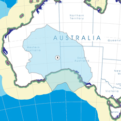
This Region defines its boundaries at the top of the ridge, where water flows one way rather than the other. This leads to a very interesting 'place'.
We are seeking a debate with people who live in this proposed new Region. We know we've got the Region pretty well correct; after all, it's just geography. But if you live in this Region you can tell us a lot of interesting things.
- Do these boundaries define a place that is unique; different to every other Region in Australia? We think that that is probably quite likely.
- Is it a great place, worthy of recognition?
- Upon formation, what should be the name of this Region? Who would be the Lord Mayor? Who would be the two Senators who represent this Region? Who would be the additional Senator that represents the interests of Aboriginal & Torres Strait Islander peoples in this region? What benefit would flow from a concept of super-Regions for the whole of the Red Centre?
- Would life be enhanced if it was on a fast Ring-Rail that links the Capital City to every other Capital City in Australia?
- Many other interesting things!
We think that this is a great new concept of regional statehood based on real concepts that define life in this particular Region. What do you think?
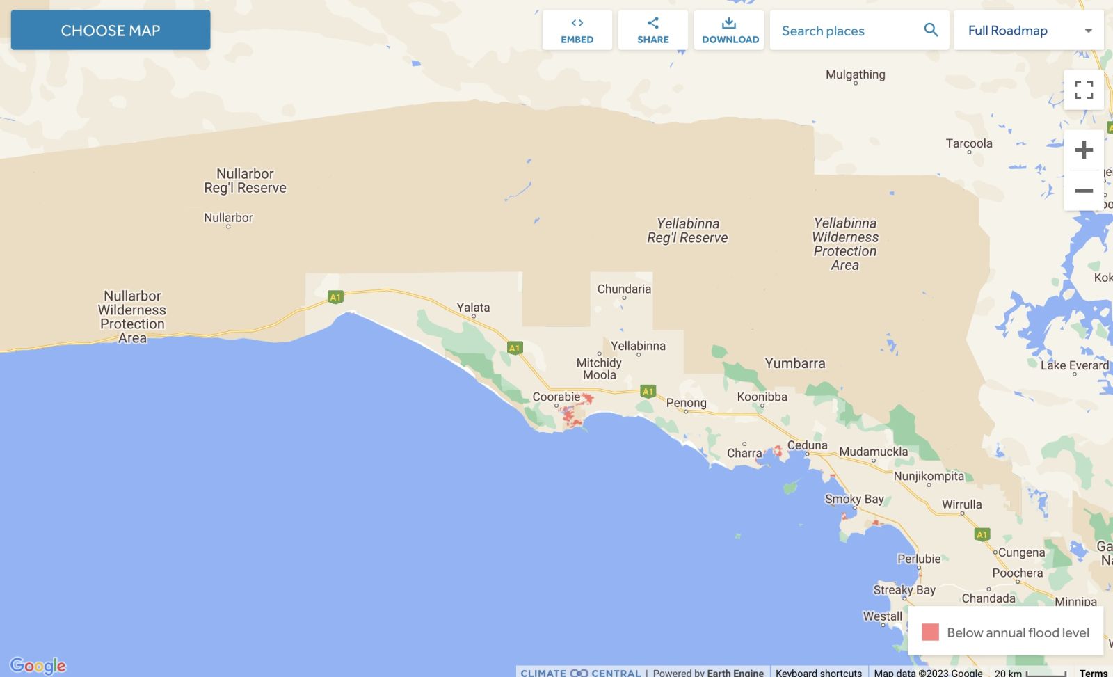
Land projected to be below annual flood level in 2050
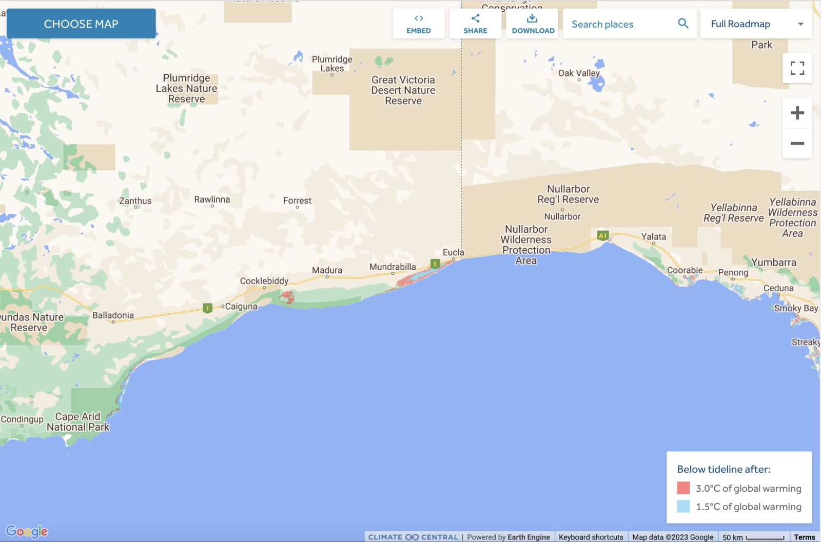
Comparison: long-term sea level outcomes
|
Aboriginal Australia:
|
|
|
NOTE1: Likely indicators only; for original Aboriginal Australia Map © 1991 & restrictions on its copy & use, see Aboriginal Australia Map NOTE2: The red line is part of the original Aboriginal Australia Map © 1991. The black line is added by Bloggerme for discussion only. It shows the likely State boundary based on the flow of water only. As "the ridge" (See FOWTOR) naturally impacts on the development of the language, social or nation groups of the Indigenous people of Australia, the proposed border is often identical to the group boundary shown on the Aboriginal Australia Map. This is as was expected. Variations are social/historical & result in a particular language, social or nation group being represented in two adjoining States. |
.JPG)
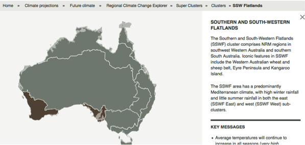 |
Other regional projections - CSIRO part of Southern & South-Western Flatlands regionThe CSIRO has regions for projecting the impact of Climate Change. See https://www.climatechangeinaustralia.gov.au/en/climate-projections/futur... This state, Great Australian Bight (X), is included in a CSIRO cluster called "Southern & South-Western Flatlands region" (exluding the tiny bit above). CSIRO's Southern & South-Western Flatlands region coincides with BloggerMe's N,P,Q, and a tiny bit of X and a tiny bit of R. |
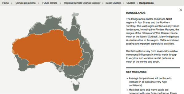 |
Other regional projections - CSIRO part of Rangelands regionThe CSIRO has regions for projecting the impact of Climate Change. See https://www.climatechangeinaustralia.gov.au/en/climate-projections/futur... This state, Great Australian Bight (X), is one of the clear projections in a CSIRO cluster called "Rangelands region". CSIRO's Rangelands region coincides with BloggerMe's L,M,X (missing a tiny bit), R (missing a tiny bit), but includes a large bit of S (the Darling River bit). |
Other regional projections - NMR - part of Rangelands WA NRM
See http://nrmregionsaustralia.com.au/nrm-regions-map/
See http://nrmregionsaustralia.com.au/Rangelands-NRM-Coordinating-Group-Inc./
Gulf Savanna Region https://rangelandswa.com.au/
Nuclear weapons
Centre ground zero CGZ - Kalgoorlie-Boulder - 475 kilotons (431 kilotonnes)
https://nuclearsecrecy.com/nukemap/
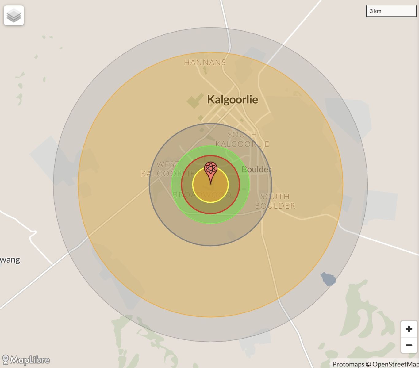
NB: population 10km around Kalgoorlie-Boulder CBD LEGEND
https://australia.places-in-the-world.com/2068823-places-within-10km-aro...
Population taken out by nuclear weapon = 24,545
Click here to:
Comments
Steve Irons
Thu, 08/10/2020 - 2:24pm
Permalink
Beauty
Bunda Cliffs
https://www.pinterest.com/pin/418553359093991433/
Coober Pedy
https://www.pinterest.com/pin/418553359094169929/
Gibson Desert
https://www.pinterest.com/pin/418553359093933222/
Lake Torrens
https://www.pinterest.com/pin/418553359094142952/
Mt Eba (nearby salt lake)
https://www.pinterest.com/pin/418553359093988457/
Outback Track, just past Australian Arid Lands Botanic Gardens
https://www.pinterest.com/pin/418553359094142430/
Woomera
https://www.pinterest.com/pin/418553359094142531/
Hidden Gorge Trail, Mt Remarkable National Park, Flinders Ranges
https://www.pinterest.com/pin/418553359094143218/
Nullarbor Plain
https://www.pinterest.com/pin/418553359094207997/
GSR - The Ghan, Adelaide to Cooper Pedy
https://www.pinterest.com/pin/418553359095020599/
Kalgoorlie sunset
https://www.pinterest.com/pin/418553359095399524/
Eyre Peninsula
https://www.pinterest.com/pin/418553359095832966/
Lorna Glan
https://www.pinterest.com/pin/418553359096155817/
Steve Irons
Sat, 26/04/2014 - 12:16pm
Permalink
CSIRO Great Australian Bight study
CSIRO @CSIROnews · 13m
Careers: Take a ‘Bight’ out of your PhD with a top-up scholarship for Great Australian Bight study http://ow.ly/w6e0g ^KL
The Great Australian Bight Research Program is a partnership initiative that involves BP, CSIRO, SARDI, the University of Adelaide and Flinders University. This $20M, four-year, multi-disciplinary, multi-agency research program aims to improve our understanding of the environmental, economic and social value of the Great Australian Bight ecosystem. The program will obtain information about the unique marine environment and potential marine resources within the Ceduna sub-basin of the Great Australian Bight, and provide vital information to decision makers to support sustainable development in the region and monitor possible future impacts.
Top-ups for Australian Postgraduate Award or Divisional (PhD) scholarships are available in 2014/15 for the following areas within the Great Australian Bight Research Program:
READ more: http://www.misa.net.au/home_page/top-up_scholarships_available_-_2014
Add new comment