Thanks for checking this Region out.
This Region is prepared on the a-political concept that if you are interested in 'place' in Australia, the most important aspect that defines 'place', is the 'flow of water'. The Senate is interested in 'place'.
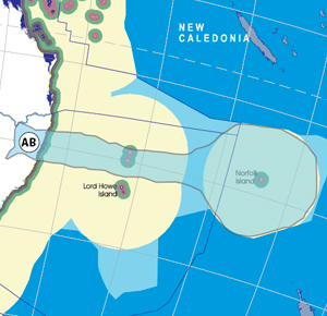
This Region defines its boundaries at the top of the ridge, where water flows one way rather than the other. This leads to a very interesting 'place'.
We are seeking a debate with people who live in this proposed new Region. We know we've got the Region pretty well correct; after all, it's just geography. But if you live in this Region you can tell us a lot of interesting things.
- Do these boundaries define a place that is unique; different to every other Region in Australia? We think that that is probably quite likely.
- Is it a great place, worthy of recognition?
- Upon formation, what should be the name of this Region? Who would be the Lord Mayor? Who would be the two Senators who represent this Region? Who would be the additional Senator that represents the interests of Aboriginal & Torres Strait Islander peoples in this region?
- Would life be enhanced if it was on a fast Ring-Rail that links the Capital City to every other Capital City in Australia?
- Many other interesting things!
We think that this is a great new concept of regional statehood based on real concepts that define life in this particular Region. What do you think?
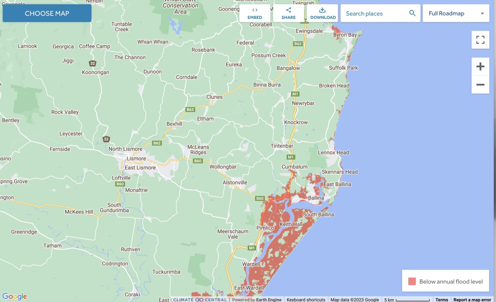
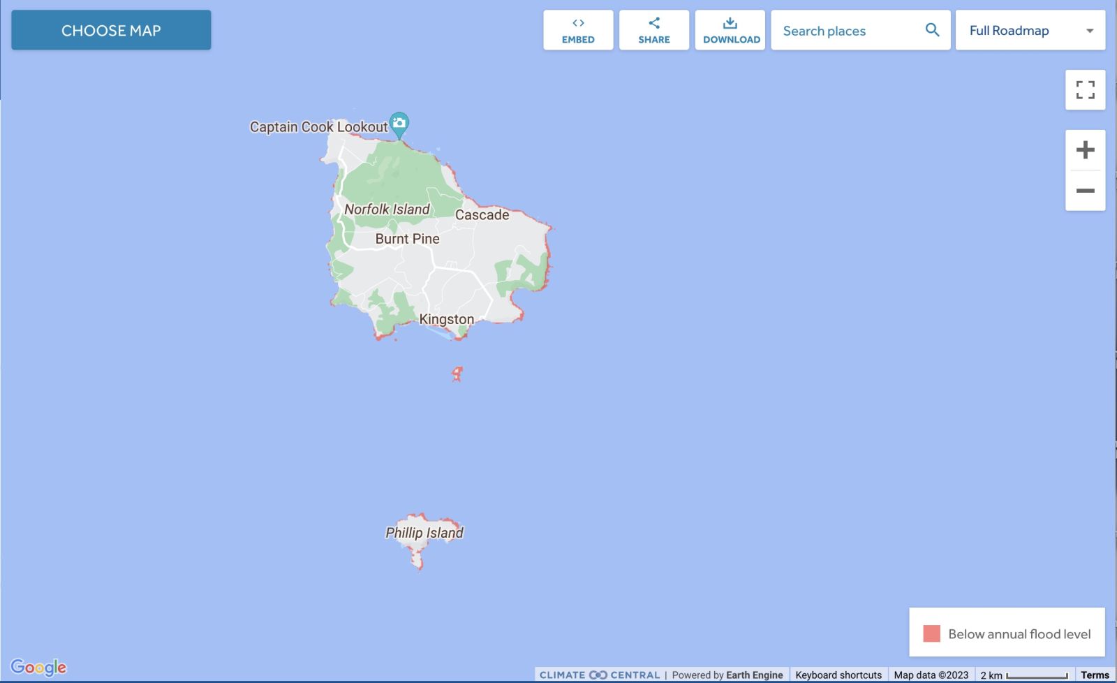
Land projected to be below annual flood level in 2050
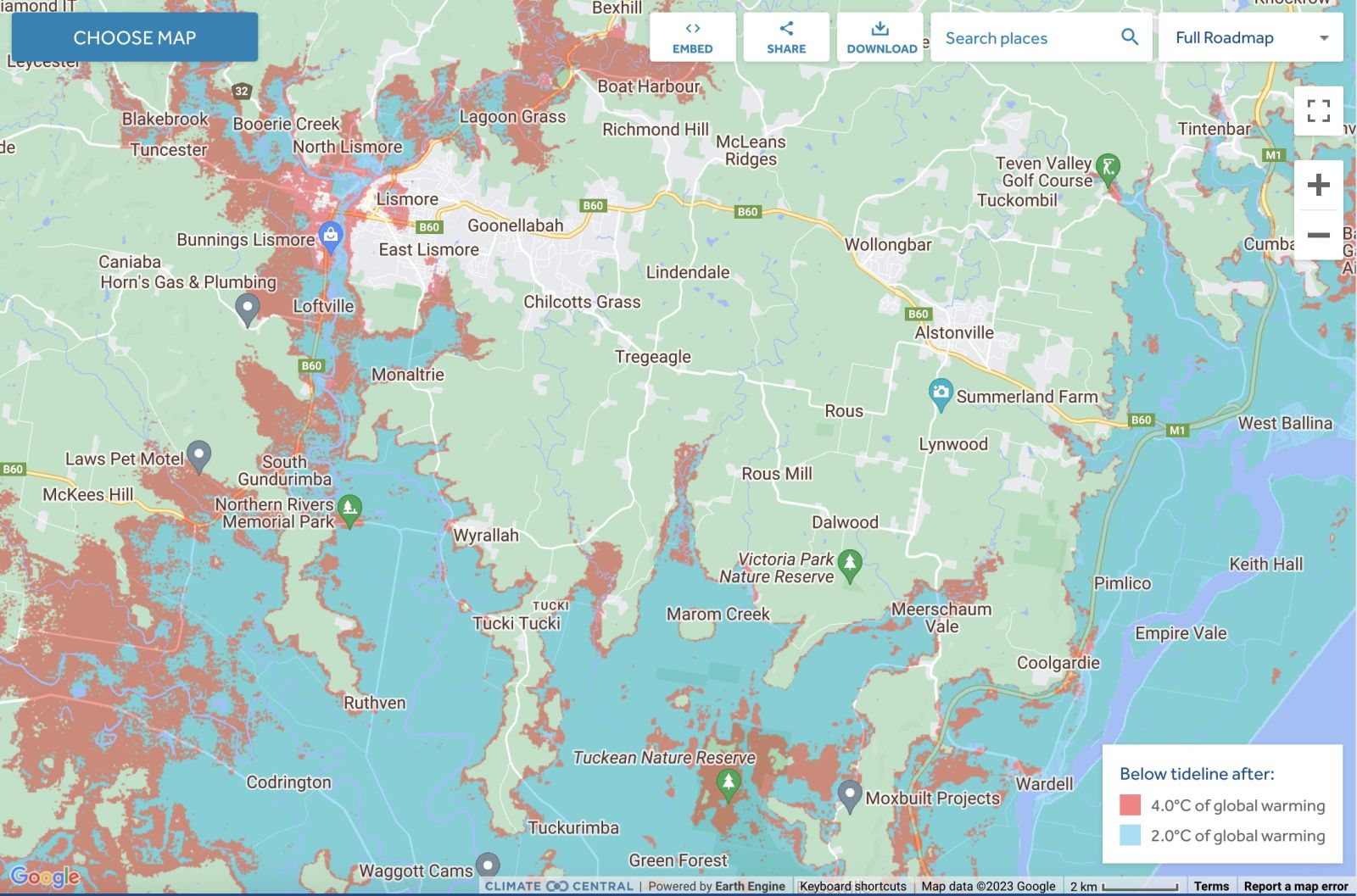
Comparison: long-term sea level outcomes
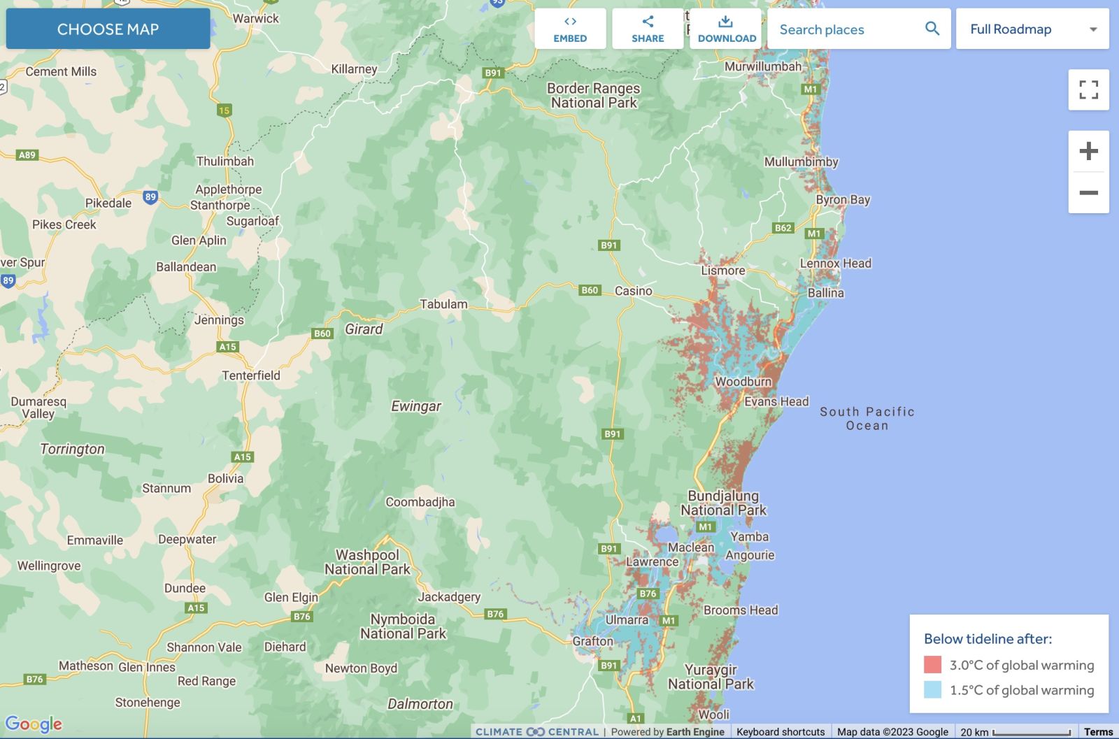
Comparison: long-term sea level outcomes
Norfolk Island - Land projected to be below annual flood level in 2050
Norfolk Island - Comparison: long-term sea level outcomes
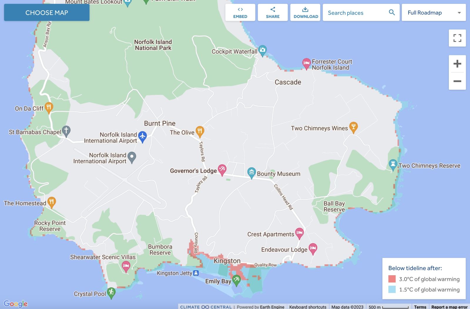
Norfolk Island - Comparison: long-term sea level outcomes

|
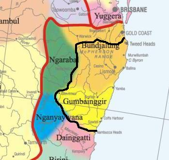
Aboriginal Australia:
|
|
|
NOTE1: Likely indicators only; for original Aboriginal Australia Map © 1991 & restrictions on its copy & use, see Aboriginal Australia Map NOTE2: The red line is part of the original Aboriginal Australia Map © 1991. The black line is added by Bloggerme for discussion only. It shows the likely State boundary based on the flow of water only. As "the ridge" (See FOWTOR) naturally impacts on the development of the language, social or nation groups of the Indigenous people of Australia, the proposed border is often identical to the group boundary shown on the Aboriginal Australia Map. This is as was expected. Variations are social/historical & result in a particular language, social or nation group being represented in two adjoining States. |
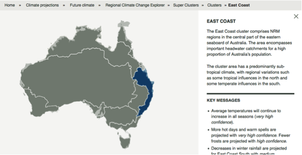 |
Other regional projections - CSIRO part of East Coast regionThe CSIRO has regions for projecting the impact of Climate Change. See https://www.climatechangeinaustralia.gov.au/en/climate-projections/futur... This state, Casino State (AB), is one of the clear projections in a CSIRO cluster called "East Coast region". CSIRO's East Coast region coincides exactly with BloggerMe's Y,Z,AA,AB,AC,AE |
Nuclear weapons
Centre ground zero CGZ - Lismore - 475 kilotons (431 kilotonnes)
https://nuclearsecrecy.com/nukemap/
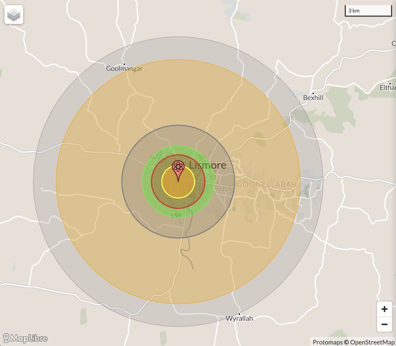
NB: population 10km around Lismore CBD LEGEND
https://australia.places-in-the-world.com/2160063-places-within-10km-aro...
Population taken out by nuclear weapon = 27,736
Click here to:
Comments
Twitter
Tue, 13/11/2012 - 5:08am
Permalink
petroleum prospecting licence
ILC UNSW @ILC_UNSW
NSW Aboriginal Land Council plans to apply for petroleum prospecting licence over 900sq km section of North Coast http://m.ballinaadvocate.com.au/news/land-councils-csg-strategy/1617561/ …
Twitter
Wed, 07/11/2012 - 4:23am
Permalink
Lismore City Council
savewater! Alliance @savewater_inc
Wyrallah Road Public wins $2,000 in Schools Water Challenge run by #Lismore City Council @northern_star_ http://ht.ly/ePHBM
Steve Irons
Sat, 03/11/2012 - 12:16am
Permalink
RDA Blogs - Coffs Harbour
http://myregion.gov.au/blogs/leadership-and-digital-era
Steve Irons
Fri, 02/11/2012 - 11:18pm
Permalink
RDA Blogs - Lismore
http://myregion.gov.au/blogs/driving-conditions-lismore-gets-top-results
Steve Irons
Fri, 02/11/2012 - 6:33pm
Permalink
RDA Blogs - Clarence Valley
http://myregion.gov.au/blogs/clarence-valley-wins-fresh-start
Twitter
Wed, 24/10/2012 - 1:20pm
Permalink
Gold mining prospecting Timbarra R
Meredith Stanton @CloudsCreek
Another gold mining company exploring within the Clarence River catchment in 2012 http://aclarencevalleyprotest.blogspot.com.au/2012/10/another-gold-mining-company-exploring.html … Timbarra River
Steve Irons
Sat, 13/10/2012 - 4:37am
Permalink
Sapphire Beach
http://instagram.com/p/QnnwxuQFTL/
Pages
Add new comment